This is manly a refactoring and code optimization effort, but as data model for rulers and ocean pattern is not changed, I have to move the version to get your old maps auto-update.
Just a few visible changes:
* Linear Rulers is replaced by Polyline ruler. It's easy to use for route distancing, just drag yellow circle to add a new point and grey to update old points. It will calculate total distance in selected scale and units
* Other rulers work almost the same as they were, but code is reworked so now rulers are stored in data, not directly in svg
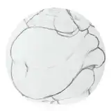
* New ocean pattern suggested by our Discord server member Kiwiroo.